NASA Data Aid Food Security Assessments in Kenya
Nearly 75 percent of Kenya’s people rely on farming for their food and income, so environmental issues like drought, locusts, and climate change can put many lives and livelihoods at risk. Crop insurance programs can help mitigate those risks, but it is not always easy to know where resources are needed. Now NASA-funded scientists are working with colleagues in Kenya to make better assessments of agricultural needs through the use of satellite data.
In the first few years of the country’s crop insurance program, Kenyan agriculture agents collected much of their information through in-person visits, traveling to individual farms to determine how crops were performing and if financial assistance was necessary. It was labor-intensive and time-consuming. Officials urgently needed timely information spanning vast areas of the country—and that is where NASA Earth observations came in.
“We suggested that instead of looking for farmers, we look at fields by using products derived from NASA satellite data,” said Catherine Nakalembe, a geographical scientist at the University of Maryland and a leader of the Africa section of the NASA-funded Harvest program. By adding satellite observations into their models and calculations, managers of Kenya’s agricultural insurance program could more readily assess critical information necessary to help farmers.
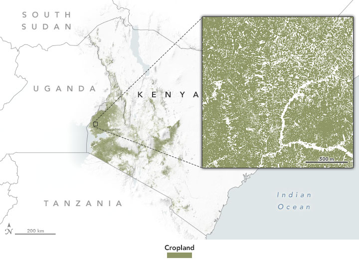
Grants from the USAID-NASA SERVIR program allowed the Harvest team and the Regional Center for Mapping of Resources for Development (RCMRD) to incorporate satellite data on rainfall, soil moisture, and land use in ways that can inform Kenya’s agriculture monitoring programs. It also supported efforts to assess crop conditions from afar by using a technique called “cropland masks.” These mapping tools use computer analyses of satellite images and data to build highly localized views of where crops are growing and the health of those fields. The Kenyan ministry and researchers in the RCMRD can then confirm the satellite data by sampling crop…